Oil Sands Truth: Shut Down the Tar Sands

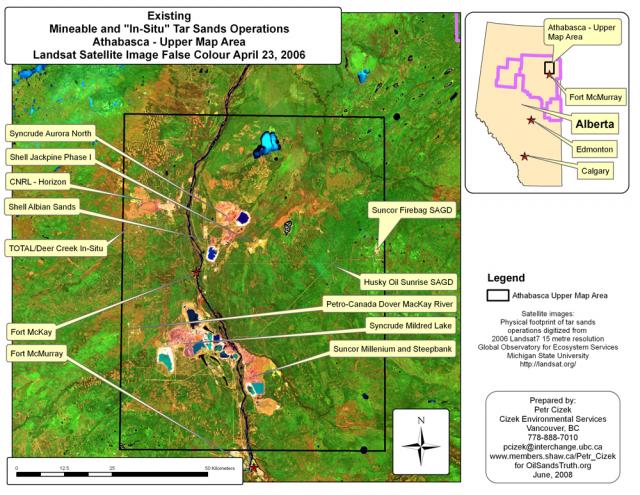
Athabasca Mineable Region Tar Sands 2006 Satellite Image

Athabasca Mineable Region Tar Sands 2006 Satellite Image

A breakdown of the existing in-situ and open pit mining project areas as of April, 2006 in the Athabasca Region's mineable zone.

click here for next Tar Sands Development map

Oilsandstruth.org is not associated with any other web site or organization. Please contact us regarding the use of any materials on this site.

Tar Sands Photo Albums by Project

Discussion Points on a Moratorium

User login

Syndicate

Syndicate content